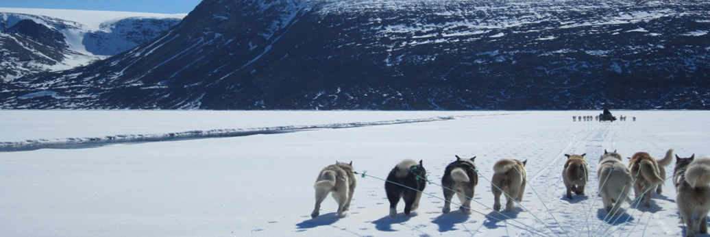
From Copernicus to the icy shores of Greenland
Imagine being a hunter or a traveller in Northern Greenland needing to navigate safely across the ice in the coastal waters of the region. Even in this harsh environment the internet and smartphone apps can be of use: The Greenland Community Ice Information Service provides satellite-based up-to-date information to plan a safe trip.

With near real-time ice information you can select the shortest route around ice ridges and open water. This not only helps minimize travel time, fuel costs and equipment wear. It also increases the safety of travel, particularly as traditional knowledge of the ice is becoming less reliable than before, due to climate change.
The service uses a simple green-yellow-red colour code to indicate where it is safe to travel. In areas marked in red there is mobile ice. Yellow areas signal rough but passable terrain, while in areas marked with green there is smooth traveling.
 Research & education networks form part of the complex infrastructure needed to turn satellite imagery into useable, accurate and timely information displayed on a smartphone. It all begins with Copernicus, the European Union’s Earth Observation Programme.
Copernicus utilizes vast amounts of images provided by dedicated satellites, the Sentinels, together with other data sources, to offer a wide range of services within renewable energy, agriculture, emergency management and much, much more. The Pan-European R&E network GÉANT and the German network DFN distributes the Copernicus data to more than 170.000 users (as of May 2018).
 The Copernicus Marine Monitoring Service delivers observations and forecasts to support a wide number of marine applications within marine safety, weather forecasting, marine resources and coastal and marine environment. The Greenland Community Ice Information Service is developed by the international organization Polar View, with the assistance of the Copernicus Marine Monitoring Service and the Canadian Space Agency.
The service is currently available in Clyde River, Nunavut, Canada, and Qaanaaq, Greenland. It integrates satellite imagery with an analyst’s interpretation of the location of the ice floe edge, and other information such as ice concentration and snow thickness from the Copernicus Marine Service.
 Although dangerous, the ice floe edge is vital to Northern communities for hunting and fishing. Furthermore it is a location of particular interest to the developing tourism industry in the region. The Greenland Community Ice Information Service was launched in late 2017.
For more information please contact our contributor(s):